7 Navigational Features
- Figure 7.1 presents the charted navigational features located in proximity to the site boundary. Each of the features shown are discussed in the following subsections and have been identified using the most detailed UKHO admiralty chart available.
- It is noted that none of the following navigational features were identified in proximity to the site boundary:
- marine aggregate dredging areas;
- IMO routeing measures;
- spoil grounds;
- pilot boarding stations;
- port approaches;
- reported or designated anchorage locations; and
- Vessel Traffic Service (VTS) areas.
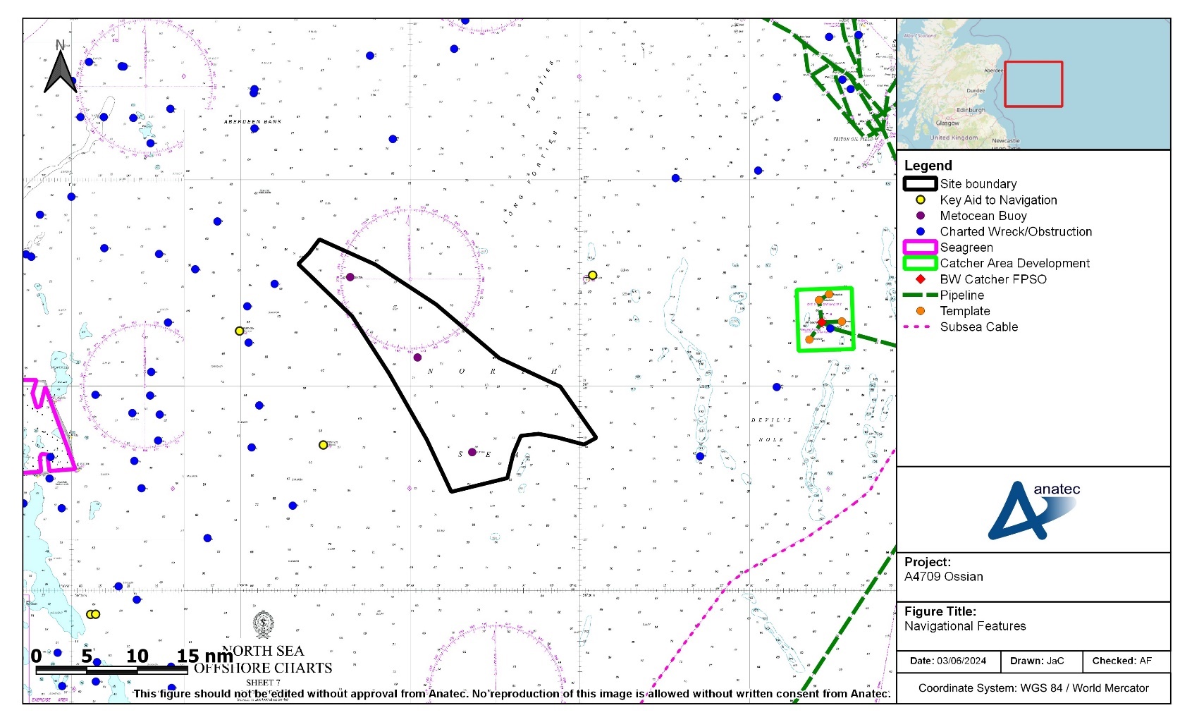
Figure 7.1: Navigational Features in the Vicinity of the Site Boundary
7.2 Charted Wrecks and Obstructions
- Charted wrecks and obstructions are more commonly found in inshore waters, rather than offshore, with none located within the site boundary. The closest is a charted wreck located 3 nm from the north-western corner of the site boundary, at an approximate depth of 67 m below CD.
- Further details of wrecks including non charted wrecks is provided in volume 2, chapter 19 (which classified two wrecks and one potential wreck in the Array).
7.3 Other Offshore Wind Farm Developments
- Seagreen 1 Offshore Wind Farm is the closest baseline offshore wind farm to the Array. It is located inshore of the site boundary, at a minimum distance of approximately 27 nm, and comprises 114 wind turbines. As of May 2024, Admiralty charts indicate the construction buoyage has not yet been removed. Cumulative offshore wind farms are considered in section 14.
7.4 Oil and Gas Infrastructure
- A Development Area (i.e., an area charted around some oil and gas fields) is charted approximately 21 nm offshore of the site boundary; vessels that are not involved in servicing the installations within the charted limits are strongly advised to keep outside via a note on the relevant Admiralty Chart. Within the limits of the Development Area is the BW Catcher Floating, Production, Storage and Offloading (FPSO) unit with a chains and anchors zone surrounding it in addition to subsea infrastructure including subsea templates[3]. A pipeline connecting to this FPSO exits the Development Area to its east.
7.5 Subsea Cables
- A subsea power cable lies south-east of the site boundary, at a minimum distance of approximately 19 nm.
7.6 Military Practice and Exercise Areas
- There are various military Practice and Exercise Areas (PEXAs) in the region, however the MOD confirmed via the Ossian Array Scoping Opinion that they “do not anticipate that the development would have any substantial impact” (MD-LOT, 2023). Further details are provided in volume 2, chapter 14.